Presagis’in faaliyetlerini sonlandırmasıyla birlikte, kullanıcılarının projelerini sürdürebilmeleri için güvenilir bir alternatif sunuyoruz.
Eğer siz de bir Presagis ürünü kullanıcısıysanız ve projelerinizin kesintisiz devamını sağlamak istiyorsanız, S-FORCE ürün ailesiyle yanınızdayız. Presagis Stage’in güçlü altyapısını temel alarak, daha gelişmiş ve esnek bir çözüm sunduk. S-FORCE, mevcut projelerinizle tam uyumlu çalışırken, çok daha güçlü özellikler ve performans artışı sağlıyor. Bu sayede simülasyon alanındaki yıllara dayanan tecrübemizle geliştirdiğimiz S-FORCE (The Smart Framework for Operational Research Combat Environment) ürün ailesini sizlere sunuyoruz.
S-FORCE ailesi, artık geliştirdiğiniz her türlü yazılım, uygulama ve eklentinin çalışabilirliğini garanti eder. S-FATE temel yazılımı, Presagis Stage ile oluşturduğunuz her projeyle uyumludur ve herhangi bir kesinti olmadan devam etmenizi sağlar.
S-FORCE, sadece askeri platform, sistem ve mühimmatların etkinliğini analiz etmekle kalmaz, aynı zamanda bu analizlerden elde edilen verilerle daha etkili, stratejik kararlar almanıza da olanak tanır. Her türlü simülasyon ihtiyacınıza uygun güçlü araçları içinde barındıran S-FORCE, sunduğu çözümlerle her zaman bir adım önde olmanızı sağlar.
- S-FATE: Savaş sahnesini en ince ayrıntısına kadar modelleyin, kompleks algoritmalar geliştirin ve stratejik analizlerle üstünlük sağlayın.
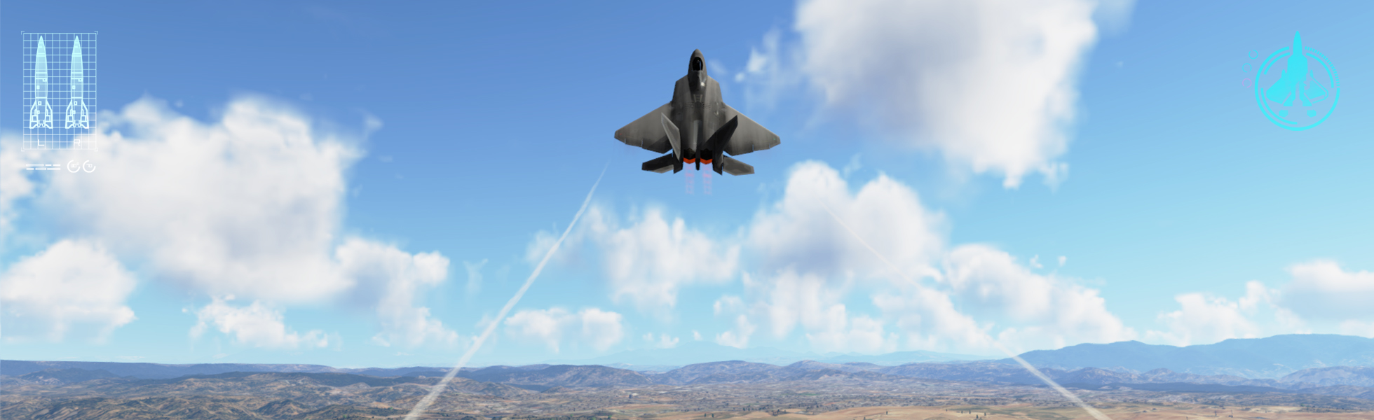
- S-VISION-3D: 3D görselleştirme ile senaryolarınızı en yüksek kalitede görselleştirin.
- S-KINEMATICS: Uçuş dinamiklerini en yüksek detaylarla modelleyin.
- S-SENSOR: Karmaşık savunma senaryolarınızı test edin ve radar simülasyonu yapın.
- S-CRAFT: Operasyonel analiz yaklaşımıyla senaryolarınızı yığın koşumda çalıştırarak mükemmelliğe ulaşın.
S-FORCE, simülasyon dünyasında devrim niteliğinde bir deneyim sunuyor ve sınırları zorlayarak başarıyı garanti altına almanıza yardımcı olmak için burada!
Geleceğin simülasyon dünyasında yerinizi alın! S-FORCE ile projelerinizde sınırları zorlayın ve rakiplerinizden bir adım önde olun. Daha fazla bilgi için bizimle iletişime geçin.
S-FORCE, simülasyon dünyasında bir adım önde olmak isteyen herkes için en güçlü çözüm!